
About this job
A real Vault job in Provo. The crew that handled it was Vault’s own W-2 team — no subcontractors, no franchisee hand-off. Same crew answers the phone and shows up at the door.
- Call any hour: (385) 250-2825 answered live 24/7. 45-min guarantee Provo (Mon-Sat 8-5); under 60 min elsewhere in Utah County.
- Who did the work: Vault’s W-2 crew, IICRC WRT/ASD/AMRT/OCT, Utah DOPL #11876543-5501.
- Insurance: Xactimate scopes submitted direct to State Farm, USAA, Allstate, Farmers, Bear River Mutual, and most national carriers.
- Pricing: water mitigation $3,500-$8,500; reconstruction $4,500-$9,500. 24-month warranty, Wisetack financing.
- Family-owned and veteran-operated, based in Provo since 2020.
See Vault in Provo, all Provo case studies, or water damage services.
Real Vault job — Riverbottoms, Provo
- Approximate location
- Near University Avenue and Riverwoods
- When
- May 2026
- What happened
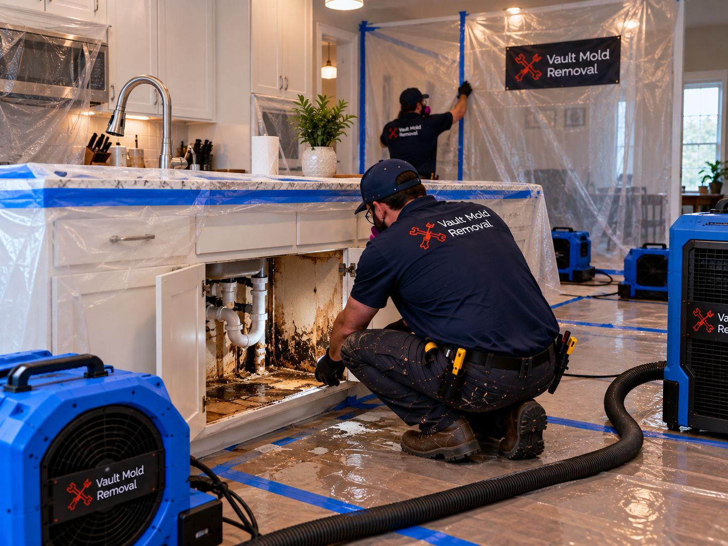
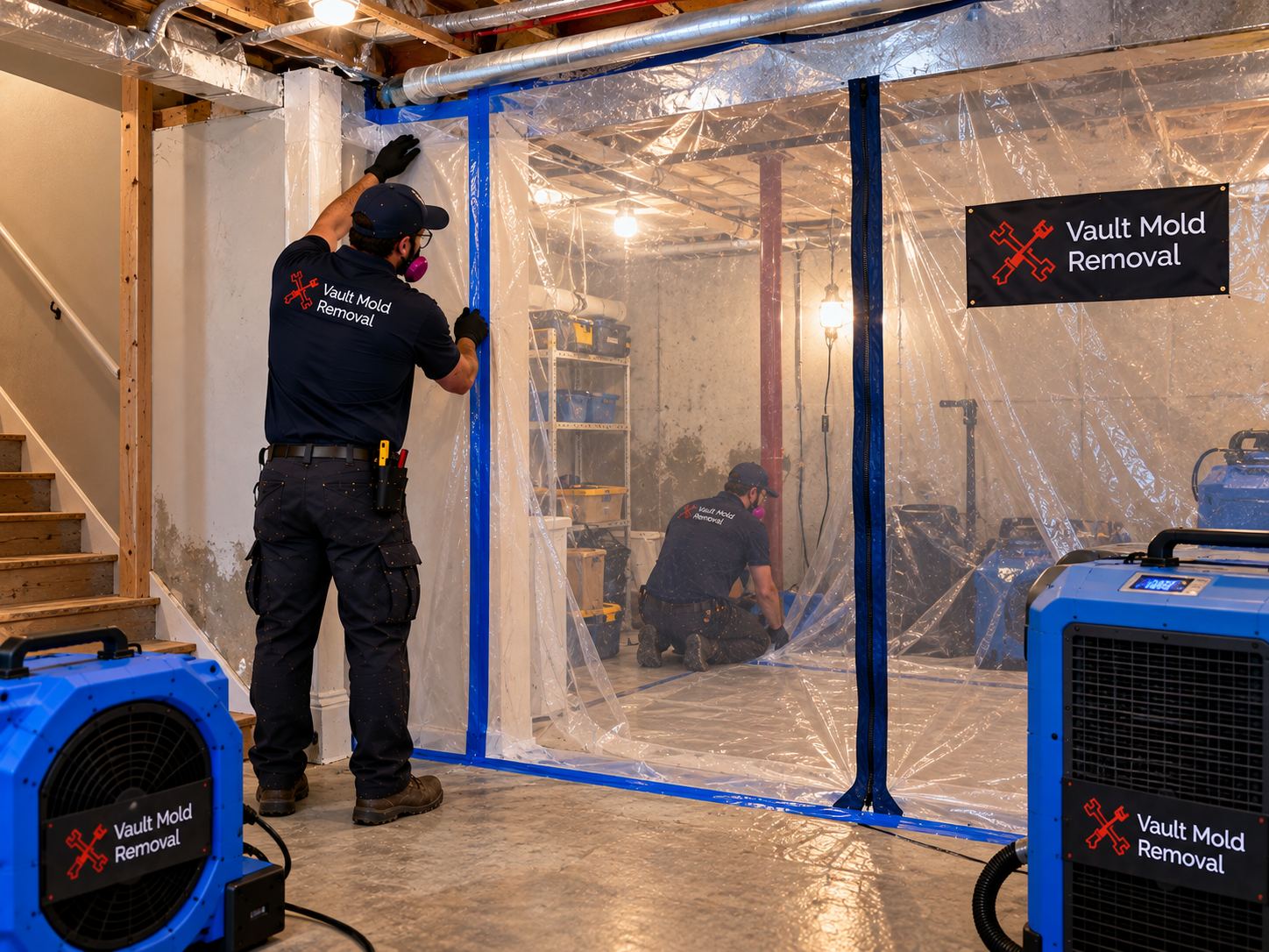
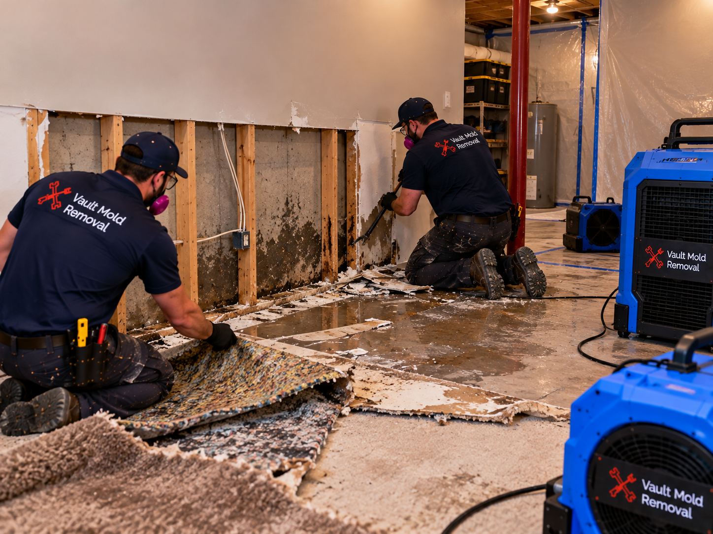
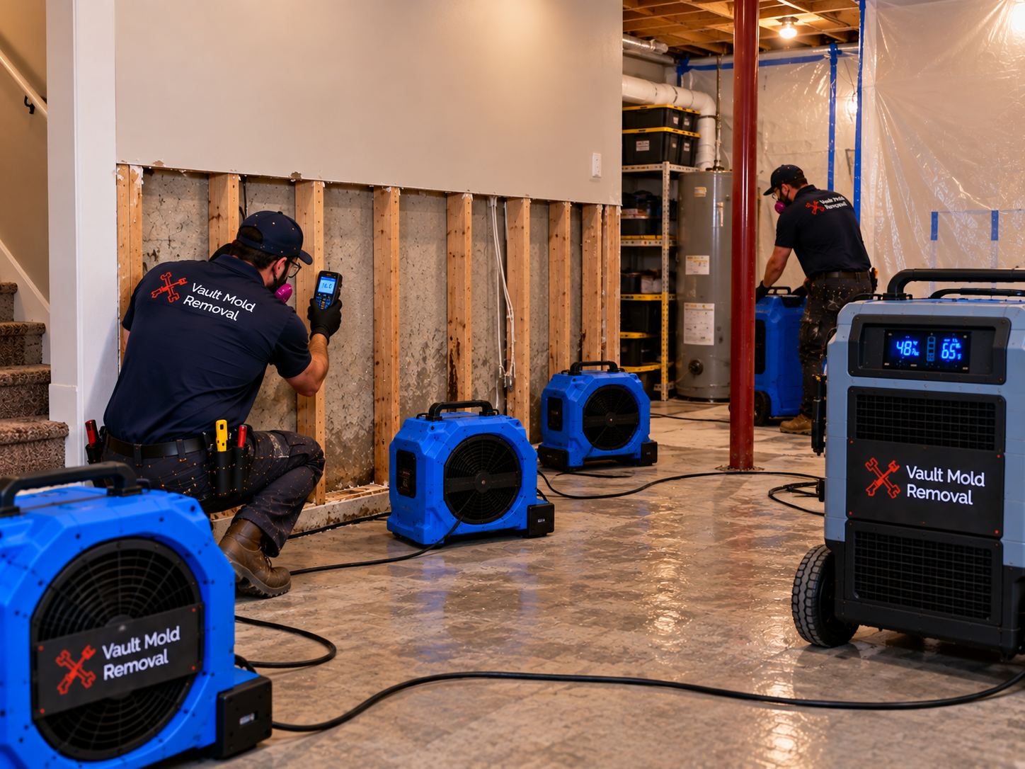
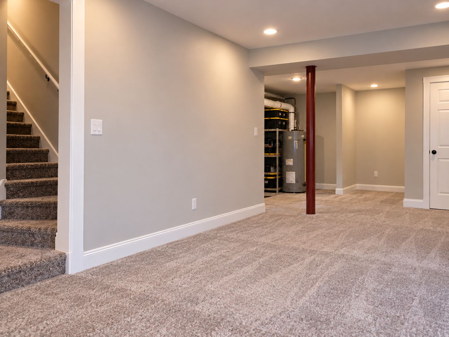
- Prolonged spring rain caused basement foundation seepage, soaking carpet padding, baseboards, and lower drywall.
- What Vault did
- Extraction and dehumidification.
Water Damage Restoration in Riverbottoms, Provo
Riverbottoms occupies the Provo River corridor as it curves southeast through Provo before emptying into Utah Lake — the neighborhood name is descriptive rather than marketing. Streets like River Road, River Grove Lane, and Bottoms Circle wind through terrain that is unambiguously river-adjacent, with mature cottonwoods, willows, and a riparian ecosystem defining much of the property character. Development happened primarily between 1955 and 1985, with earlier construction closer to the historic river channel and later infill on higher elevations away from the flood-prone bottoms. From a water damage standpoint, Riverbottoms has the specific characteristic of a documented floodplain history — some homes are within the FEMA-designated Special Flood Hazard Area, and groundwater intrusion during high-water years is a real consideration for basement and crawlspace losses that most Provo neighborhoods don’t share.
Response time from our Provo dispatch to a Riverbottoms address averages 24 minutes daytime and 48 minutes overnight, logged over three years of dispatch records. Northern Riverbottoms away from the immediate river corridor runs 22 to 24 minutes daytime. Southern Riverbottoms closer to the Utah Lake outlet runs 26 to 28 minutes daytime.
Floodplain and Groundwater Considerations
Portions of Riverbottoms are within the FEMA-designated 100-year Special Flood Hazard Area — Flood Zone AE or Flood Zone A depending on specific parcel — which affects insurance coverage in specific ways. Standard HO-3 homeowners policies exclude flood damage; separate NFIP flood insurance policies or private flood insurance is required for flood-source coverage. When we respond to a Riverbottoms water event, one of the first questions is source: plumbing failure (typically covered under HO-3), groundwater intrusion during high-water years (typically excluded from HO-3, potentially covered under NFIP if in force), surface flooding from the Provo River during flood events (excluded from HO-3, covered under NFIP if in force), or sewer backup (excluded from HO-3, may be covered under specific endorsement).
Diagnosis distinguishes source. Water samples get tested for chlorine residual (indicates municipal supply), sediment content (indicates surface water), and biological content (indicates sewer). Interior distribution patterns are mapped — plumbing sources concentrate near supply runs; groundwater or surface flooding enters through foundations, window wells, or floor cracks; sewer backup enters through drain fixtures. Source determination affects both restoration approach and insurance coverage conversation.
What Riverbottoms Construction Looks Like
Mid-century Riverbottoms residential (about 70% of housing stock, 1955-1975). Standard Provo mid-century profile: platform framing, copper supply lines, cast-iron drain with ABS conversions, drywall over 2×4 framing, forced-air HVAC. Foundations are mixed — full basements on higher-elevation parcels, shallow crawlspaces or slab-on-grade on lower parcels near the river corridor where high water table made deep foundations impractical.
Later infill (1975-1985, about 20% of housing stock). Similar mid-century profile with some updated materials — later copper installations, ABS drain more universal, standard drywall assemblies. Foundations increasingly slab-on-grade in newer construction on floodplain-adjacent parcels.
Newer construction (post-1990, about 10% of housing stock). Modern profile with engineered floor systems, PEX manifold plumbing, sometimes elevated foundations to comply with FEMA floodplain requirements. Homes built after floodplain mapping updates often have specific flood-resistant construction features — elevated finished first floors, flood vents in enclosed lower areas, materials rated for below-flood-elevation use.
Riparian Environment and Groundwater
The Provo River corridor maintains a high water table throughout Riverbottoms even in normal-water years. Below-grade construction sits within a few feet of groundwater level in some parcels, which affects restoration in specific ways. Basement drying can be complicated by groundwater migration through foundation cracks or below-slab pathways — moisture readings that don’t drop as expected during drying may reflect ongoing groundwater contribution rather than incomplete drying of loss water. We test with hygrometric survey of surrounding soil during extended drying to distinguish loss water from groundwater intrusion.
Sewage systems and septic tanks (some older Riverbottoms parcels use septic rather than municipal sewer) face specific challenges in high-water-table environments. Septic failures during high-water years produce Category 3 losses complicated by ongoing intrusion issues. When septic failure is contributing to a Riverbottoms loss, source remediation requires licensed septic contractor coordination before restoration can complete.
Typical Riverbottoms Failure Patterns
- Groundwater intrusion during high-water years
- Spring snowmelt from Wasatch snowpack peaking in April and May can raise Provo River levels and adjacent groundwater. Below-grade spaces on floodplain-adjacent parcels can see intrusion during peak years even without direct river flooding.
- Copper pinhole leaks in mid-century original installations
- Age-related failure of original copper supply lines, same neighborhood-wide pattern as adjacent mid-century Provo neighborhoods.
- Water heater tank rupture
- Standard failure mode. Basement mechanical rooms in Riverbottoms often have inadequate drainage for full tank release, complicated by groundwater proximity.
- Sewer backup or septic failure
- High-water-table environments stress sewer and septic systems during peak seasons. Category 3 losses require specific handling.
- Surface flooding during major Provo River events
- Rare but not unheard of. Major snowmelt years or reservoir management events can produce river flooding in the SFHA. Covered under NFIP only.
Insurance Documentation for Riverbottoms Losses
Utah Code 31A-26-301.5 requires acknowledgment within 15 days and coverage determination within 30 days of proof of loss. Riverbottoms claims involve additional coverage complexity given the floodplain considerations. If your property is within FEMA Flood Zone AE or Flood Zone A, you may carry both a standard HO-3 policy (State Farm, USAA, Allstate, Farmers, Bear River Mutual are common) and a separate NFIP or private flood policy. Different sources trigger different policies; we document accurately to support the appropriate coverage.
Watch-item on Riverbottoms claims: the “source of water” determination is more consequential here than in most Provo neighborhoods because coverage varies significantly by source. Plumbing failure documentation supports HO-3 coverage; groundwater or surface flooding supports NFIP coverage (if in force); sewer backup requires specific endorsement. Accurate diagnosis matters both for restoration approach and coverage.
Frequently Asked Questions
- My property is in Flood Zone AE. What does that mean for water damage insurance?
- Standard HO-3 homeowners policies exclude flood damage regardless of flood zone designation. Separate flood insurance — either through the National Flood Insurance Program (NFIP) or a private flood carrier — is required for flood-source coverage. Coverage decisions are the carrier’s, but source determination (plumbing vs. groundwater vs. surface flooding vs. sewer) affects which policy responds. If you have both HO-3 and flood insurance in force, the correct source documentation supports the appropriate claim. If only HO-3, plumbing-source damage may still be covered even if flood-source damage isn’t.
- Water is coming up through my basement floor during spring runoff. What is that?
- Typically hydrostatic groundwater intrusion — high water table pushing water through foundation floor cracks, cove joints between wall and floor, or floor drains. This is not a plumbing failure and is not covered under standard HO-3 policies. NFIP coverage (if in force) may respond depending on specific circumstances. We diagnose accurately, document source, and help you present the appropriate coverage claim to whichever carriers are on the risk.
- My crawlspace has standing water and I’m not in the mapped flood zone. Where’s it from?
- Depends on the source. Groundwater intrusion is possible even outside mapped SFHA if the water table is elevated and your crawlspace is at or below groundwater level. Failed exterior drainage systems (French drains, downspouts, grading) allowing runoff into the crawl is another common source. Plumbing failure inside the crawl is a third possibility. We test water samples for chlorine (municipal supply indicator), sediment (surface water indicator), and biological content (sewer indicator) to distinguish sources.
- I have septic instead of municipal sewer. Does that affect the response?
- Yes. Septic failure produces Category 3 black water losses regardless of source (drainfield failure, tank rupture, sewer backup into the drain system). Category 3 requires containment, personal protective equipment, removal of affected porous materials, and specialty disposal. Source repair requires licensed septic contractor coordination. Restoration timing depends on septic source repair completion. This is more complex than municipal-sewer situations and takes longer.
- How do I know if I’m on a floodplain?
- FEMA maintains Flood Insurance Rate Maps (FIRMs) available at msc.fema.gov by address. Provo City also maintains local floodplain mapping. Your mortgage lender required flood insurance documentation at closing if your property was in the SFHA at that time, though maps update periodically and current status may differ. If you’re uncertain, checking current FEMA maps for your specific address takes a few minutes online and is worth doing before any water event happens.
Contact Vault Mold Removal
Phone: (385) 250-2825
Address: 1169 S 760 W, Provo, UT 84601
Hours: Monday–Saturday, 9:00 AM – 5:00 PM
Service Area: Riverbottoms, all Provo neighborhoods, and surrounding Utah County communities.
Water damage in Provo?
Call (385) 250-2825 — answered live 24/7 by the Vault crew, not a call center. Inside Provo city limits, Monday–Saturday, 8 AM–5 PM, we guarantee arrival in 45 minutes — see the terms.
Real Vault jobs in Provo
Each of these is a real job done by Vault’s own W-2 crew. Call (385) 250-2825, answered live 24/7.
- Downtown — February 2026
- East Bay — July 2026
- Edgemont — June 2026
- Foothills — May 2026
- Franklin — December 2025
- Franklin South — March 2026
- Grandview North — September 2026
- Grandview South — August 2026
- Indian Hills — April 2026
- Joaquin — November 2025
- North Park — January 2026
- Oak Hills — July 2026
- Provost — June 2026
- Riverbottoms — May 2026
- Rivergrove — March 2026
- Rock Canyon — February 2026
- Sherwood Hills — April 2026
- Sunset — August 2026
- Timp — December 2025
- Wasatch — January 2026
- 1908 Joaquin Bungalow Galvanized Failure
- Downtown Mid-Rise Sprinkler Discharge
- Edgemont Hidden Crawlspace Pinhole
- Foothills Walkout Washer Cascade
- Franklin Sewer Backup Root Intrusion
If a job like this is happening to you
Vault handles jobs like the one above every day across Utah County. Here’s what else is worth reading before you call:
- Why Vault — W-2 crew, 45-min Provo guarantee, in-house mold clearance, no franchise call center.
- Insurance claims — how we document the damage and bill State Farm, USAA, Allstate, Farmers, Bear River Mutual directly.
- 24-month warranty — what’s covered and how to open a claim.
- Wisetack financing — $500-$25,000 over 3-24 months, soft credit check.
- Service area — confirm your city is one of the 6 we cover.
- Water damage timeline — why every hour of head start cuts the final bill.
Call now: (385) 250-2825 — answered live 24/7 by the Vault crew.
Photos from this Riverbottoms job
Real photos taken by the Vault crew during this Riverbottoms, Provo water damage job in May 2026 — basement seepage near University Ave / Riverwoods.
Dealing with something similar?
This job started with basement seepage during snowmelt. If that sounds like what you’re facing, these guides cover what to do first:
Spring flood prep in Utah · Mold in your basement
Or call (385) 250-2825 — answered live 24/7.
Helpful guides: What if water damage isn’t fixed? · Documenting damage for insurance
Need help with a job like this?
water damage restoration in Provo · emergency water damage restoration in Provo · sewage cleanup in Provo · mold remediation in Provo
Have a job like this in Provo? See water damage restoration in Provo, or call (385) 250-2825 for a free written estimate.